Ulteig Exceeds Expectations in Renovating Historic Lewis & Clark Expedition Route in North Dakota
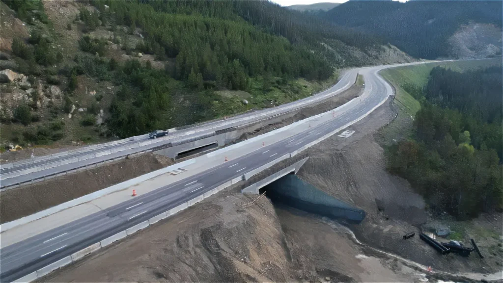
Williston, North Dakota — The historic highway ND 1804, while sturdy before, was not originally built to handle a heightened amount of road use. In 2010, the Bakken Oil Boom caused a 400% increase in average annual traffic along the route, 45% of which was heavy-duty truck traffic hauling oil. Not only did traffic increase, but speed did as well, from 50 mph to 65 mph. This increased the minimum stopping sight distance to notice obstacles and brake to avoid said obstacle from 13 car lengths (at 50 mph) to 21 car lengths (at 65 mph). In order for the roadway to be able to temporarily handle these changes in traffic, the existing roadway was posted for reduced weight limits. An entire re-construction of the highway was due — and Ulteig was called upon to make it happen.
Challenges overcome
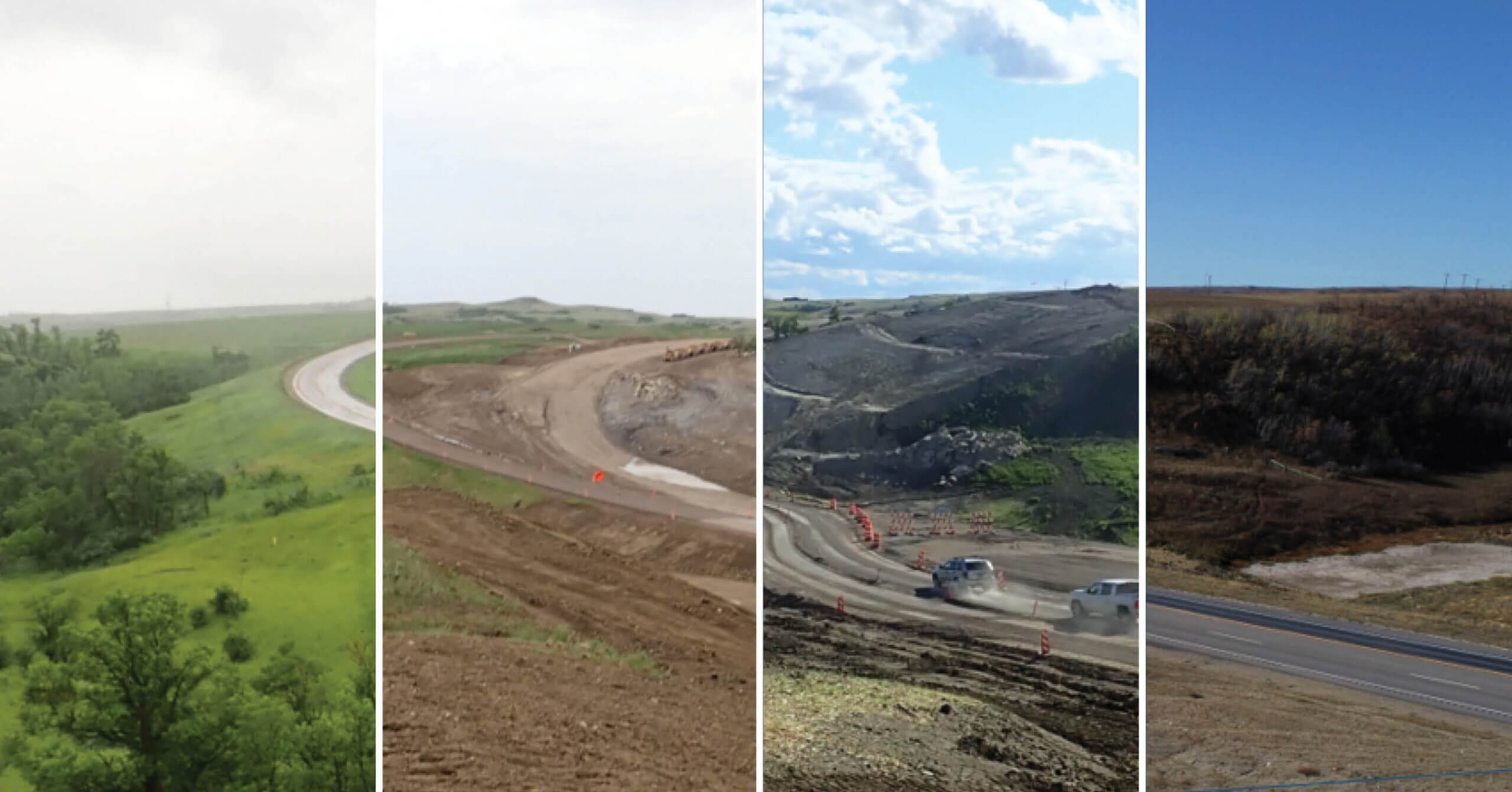
The complexity of the rolling hills, land slide area, stream hydraulics, USACE recreational land, and cultural sites surrounding the construction area proved to be mighty obstacles.
When working with rolling terrain, one needs to address opportunities for passenger vehicles to pass large vehicles on steep grades. This is accomplished by adding passing/climbing lanes. Because of rolling terrain, all intersections and accesses were reviewed for intersection sight distance, and several driveways had to be relocated due to inadequate sight distance.
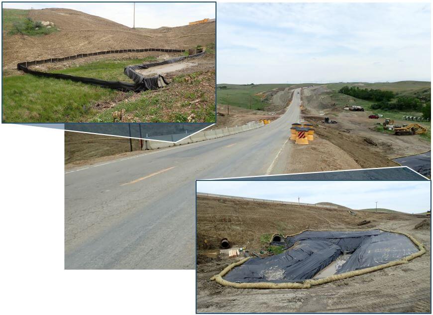
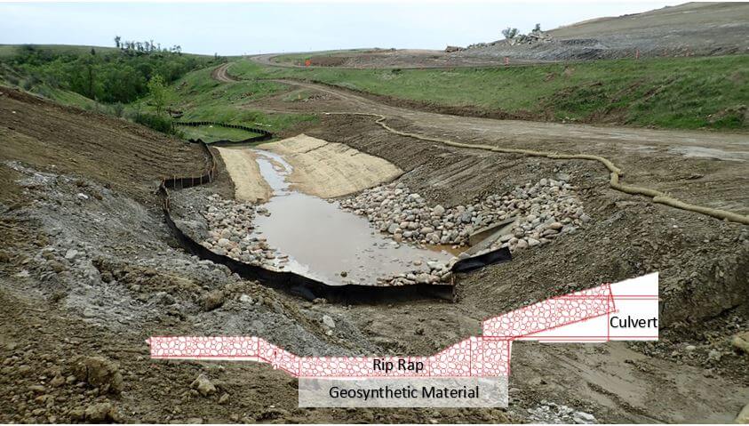
There was an existing large hill approximately halfway through the project that contained lignite seams with an active slide, and the existing ditches and culverts had steep grades, requiring several energy dissipation measures to be considered. A combination of adjusting ditch grades, riprap, riprap basins, baffle rings, broken-back pipes, and drop manholesere incorporated into the design to mitigate pipe velocities.
The project also traverses a mile of recreational USACE-controlled lands along White Tail Bay. White Tail Bay is part of the Lake Sakakawea-operating flood pool, requiring any material placed below an elevation of 1858.6 feet to be mitigated. White Tail Bay had just recently had a second boat landing constructed at a new location to accommodate seasonal changes in the lake levels. This roadway improvement constructed a right turn lane at the new access. The initial concept would have resulted in the costly extension of a triple barrel box culvert, but our team proposed shifting the access easterly, avoiding the box culvert extension and allowing more room to improve the access grades. The cumulative effect of roadway widening, turn lanes, and access improvements, could have had severe impacts to the USACE flood pool. Ulteig leveraged its experience from previous projects and proposed lowering the roadway to maintain the original footprint and provide a widened ditch along the roadway to mitigate all flood pool impacts.
Respect for the Land, and the People
Along this historically rich corridor, Ulteig’s transportation specialists located 55 cultural sites. To be respectful of the land and the people who lived there, Ulteig invited both a culture specialist group, Beaver Creek Archeology, and a group of tribal monitors to evaluate the land before construction took place — a standard practice for any North Dakota Department of Transportation (NDDOT) project. It was important for us to build a strong relationship with the Indigenous peoples, and by collaborating and using ingenuity allowed withing design guidelines, no cultural sights were impacted.
Ingenuity Fit for History
Thanks to the dedication and expertise of the engineers and ROW specialists involved in the project, the team was able to configure solutions for these obstacles that were, in some cases, even better than the original concepts.
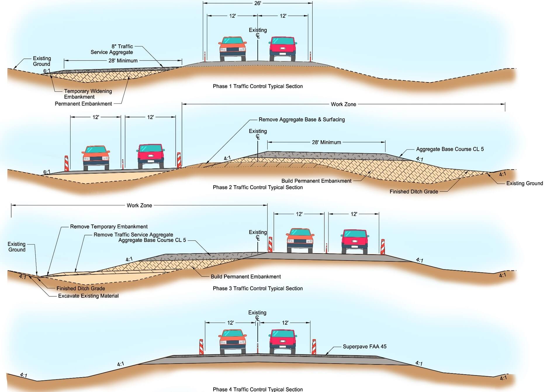
In order to meet current traffic demands, address roadway deficiencies, and provide for two-way traffic during construction Ulteig incorporated the following design elements:
- Provided geometric improvements to correct 11 vertical curves, 6 horizontal curves, and 1 complete realignment.
- Reviewed all existing accesses for intersection sight distance.
- Repaired an existing slide area by removing all unsuitable material and implementing a subsurface drain system to wick water away from existing lignite seams.
- Incorporated five passing lanes at strategically located areas at steep hills to allow drivers the opportunity to pass larger trucks that cannot maintain speeds.
- Increased structural capacity of the roadway led to the removal of load restrictions: This allows hefty oil truck traffic to pass through the corridor with ease.
- Work with adjacent business owners, ranchers, and residents to address their concerns along the roadway. Improvements included additional turn lanes, modifying accesses, additional signage for seasonal cattle crossing roadway, etc.
- Provided modeled surfaces for each phase of construction to allow for more accurate bids, reduce construction time, and ensure drivability for public travel.
These improvements restored the structural capacity, enhanced the sight lines along the highway, and improved the driving experience between people driving in cars and the growing number of heavy-duty trucks using the roadway.
Strong Community Relationships Make the Difference
Josh Kueber, P.E. Ulteig Senior Project Engineer, and Thomas Fakler, P.E., Technical Manager with Ulteig’s transportation team, attribute the success of the two-year project to the strength and expertise of their team, and their ability to coordinate with multiple agencies to cohesively complete the project. Ulteig was able to complete the environmental analysis and design within one firm, and collaboration during monthly meetings with the North Dakota Department of Transportation, the U.S. Army Corps of Engineers and the Federal Highway Administration led to a smoother process overall.
Besides communicating with the stakeholders, and coordinating with 38 different land owners, assessing the needs of the community where the project took place was also a necessary ingredient to the success of the project.
For this project, Ulteig was able to develop an app that was consistently updated with live information about the ROW status, ensuring that the North Dakota Department of Transportation was always up to date.
Equipped with expertise of the highest caliber, along with years of experience developing projects of this scale, the engineers at Ulteig ensured that this project was marked for success from the very beginning.
The client, the North Dakota Department of Transportation, was so impressed with the final product that they authorized the entry of the project in the American Council of Engineering Companies of North Dakota’s 2021 Engineering Excellence Award competition, noting the project’s, “outstanding features, unique aspects, and innovations.”
Ulteig is the One for the Job
The story of Highway 1804’s reconstruction provides hope for rural areas throughout the U.S. and Canada that are in need of updated, reliable transportation infrastructure. Ulteig’s transportation engineers leverage their expertise to craft solutions to meet the needs of local areas today…and tomorrow.