
Leveraging the Power of GIS to Increase the Effectiveness of Infrastructure Design, Planning and Construction
November 17, 2021
Happy International GIS Day!
Celebrating GIS Technology and its Impact on International GIS Day, November 17, 2021
The average person may look at a piece of infrastructure and never know the planning that went into the design and construction. But at Ulteig, we know that every inch matters when it comes to placement in the environment. In the world of engineering, it can mean the difference between incredible success and utter, preventable failure.
So when the world of engineering celebrates International GIS Day on November 17, 2021, we wholeheartedly celebrate not only the history and impact of GIS on the world of infrastructure, but the folks at Ulteig who have made GIS their calling.
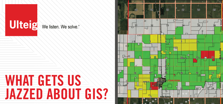
Pinpointing exact locations. Harnessing data. Visualizing solutions. Geographical Information Systems (GIS) give engineers at Ulteig powerful information to customize geospatial solutions for its clients. Pioneered by English geographer Roger Tomlinson who coined the term “geographical information systems” in 1963, GIS has evolved with successive waves of computing, software, and satellite technology to become a critical function in the design, planning and construction of infrastructure.
Ulteig’s wide-array of GIS solutions range from field data collection, custom mapping to web and mobile application development and technical support for the Lifeline Sectors® – power, renewables, transportation and water – served by Ulteig.
GIS technology allows Ulteig engineers to work with real-time interactive information (not static), which can easily be accessed from any office in the world, or in the field (with mobile apps) at a project site. By combining the visual benefits of mapping with the power of a database, GIS helps contribute to data asset management and project status tracking, while enhancing communications between stakeholders throughout the project.
“The entire goal of using GIS is to make life easier for our engineers and their clients,” said Mike Schnetzer, Senior GIS Analyst with Ulteig. “By using real-time information, we increase the accuracy of what we’re seeing, enhance collaboration; increase time savings and streamline the design process.”
One of the most important elements of GIS is its capacity to help people collaborate better on projects by providing them more accurate information.
“I enjoy working with GIS because it allows engineers to be more collaborative and creative,” said Greta Robinson, Lead GIS Analyst for Ulteig. “In my role, I’m always learning something new. Spatial data analysis can be applied to most disciplines and problems we face in the modern world. Helping others see that potential is exciting to me.”
Joel Feik, another Lead GIS Analyst for Ulteig, explains that GIS can help people solve problems better because it allows engineers to visualize potential solutions.
“For me, GIS engages both the analytical and creative sides of my brain,” said Feik. “On the one side, I enjoy overcoming challenges dealing with practical real-world problems. On the other side, I love creating eye-catching maps and enticing visuals.”
Integrating GIS into Ulteig Projects
With newer forms of GIS technology, GIS is increasingly becoming an essential tool in helping Ulteig collaborate with its clients. Ulteig’s GIS services include a range of tools, including:
- Data collection and custom mapping,
- Design reviewer and real-time monitoring applications,
- Esri software solutions, technical support for utilities,
- 360 Video Mapping Integration,
- Mixed-reality Remote Assist,
- GIS Assessments and implementation plans,
- Mobile mapping solutions,
- Site selection analysis,
- Suitability modeling, and
- Utility mapping and modeling.
“GIS is such a powerful tool, that even using some of its simplest functions makes us and our clients look like heroes,” said Dan Haglund, a Lead GIS Analyst for Ulteig.
GIS has become a critical part of the Ulteig planning process. It’s a technology that we believe should be considered for most projects. The use of GIS in a project can produce a range of benefits, such as:
- Creating interactive inventory-maps
- Sharing updated data in real-time with staff in the field and in the office
- Decreasing survey and design time
- Flexibility to scale data to the project parameters
- Eliminating separate copies and versions of designs and data from a centralized database
- Referencing facilities data such as size and type, and pictures from the office
- Increasing accessibility to data
- Tracking the status of design, construction, and easement acquisition
- Connecting with intuitive modern smartphone apps and web apps
“GIS technology allows us to deliver more value to our clients,” said Schnetzer. “Lower research costs, less travel time to a site, more useable data, better project tracking and enhanced communications between our firm, the client and other project stakeholders. We believe our investment in GIS technology as well as the people who understand how to bring it to life is a clear demonstration of our commitment to putting driving better solutions for our clients.”
Learn more about GIS at Ulteig
Want to learn more about GIS at Ulteig? GIS is an integral part of the design and planning process at Ulteig. For an overview about our GIS services, click here. To learn how GIS can increase the cost effectiveness of your next project, read this article: Increase Cost Effectiveness by Incorporating GIS into Your Next Project.
WHAT MAKES ULTEIG DIFFERENT?
From global energy producers to locally funded cities and private developers to government agencies, the clients we serve encompass a broad range of relationships and projects. Find out why Ulteig is a leader in the engineering industry.
Contact Us