One Common Language: How Ulteig’s Advanced GIS Capabilities Are Revolutionizing Management of Lifeline Sector Projects
July 21, 2022
Intertwining geospatial data, program and project management support, technology integration and team communication into one simple, user-friendly interface, Ulteig’s GIS Department sets a new standard for collaborative communication, data accuracy, efficiency, and time savings. It represents just another example of the innovative thinking that Ulteig is developing to better manage projects for its Lifeline Sector clients.
A truly successful, satisfying engineering project – whether it’s a solar project, a new bridge or a water treatment plant – doesn’t just happen. It requires a commitment to communication between all of the experts involved and the availability of the most accurate information to maximize results.
As we reported back in September 2020, Ulteig is continuously looking to incorporate new technology into its processes to deliver the greatest value to its clients. For example, Ulteig has a long history of providing centralized Geographic Information Systems (GIS) solutions to support our key Lifeline Sectors® of Power, Renewables, Transportation and Water. GIS technology supports engineering projects by combining the visual benefits of mapping with the power of a database. The technology contributes to data asset management and project status tracking and enhances communications between stakeholders throughout the project.
However, up to this point, options were limited for allowing seamless communication between all of the players involved in a project or portfolio of projects, providing holistic, real-time data to thrive in unison – until now.
Leveraging software developed by ESRI, Ulteig has developed a dynamic, holistic, and user-friendly online interface through which all parties involved in a project – including developers, construction firms, engineering firms, right-of-way specialists, sub-consultants, etc. – can easily and instantly track the status of a project and make real-time progress updates.
This solution represents an innovative step toward a client experience that will enhance the quality, efficiency and cost savings of infrastructure projects.
Harnessing the Data
Let’s face it. There’s so much data involved in any given project, that it can feel like herding cats. Corralling that data from multiple parties and creating one destination where anyone involved in the project can quickly and easily understand exactly what’s happening in real time has been a challenge that has vexed project management for years.
 “All of the data available on a project or portfolio can quickly become overwhelming,” said Keith Weatherby, Director of Field Services at Ulteig. “But with our online GIS interface, we can filter, organize and present the abundance of data in a way that helps everyone involved understand the status of a project, what information is available and how to seamlessly transfer that information between different parties.”
With the GIS Department’s online interface, all of these components, and more, are readily available at the glance of an eye:
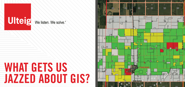
- Data collection and custom mapping with offline and online data access, including a visualized land parcel status indicating what land is acquired, pending, or rejected.
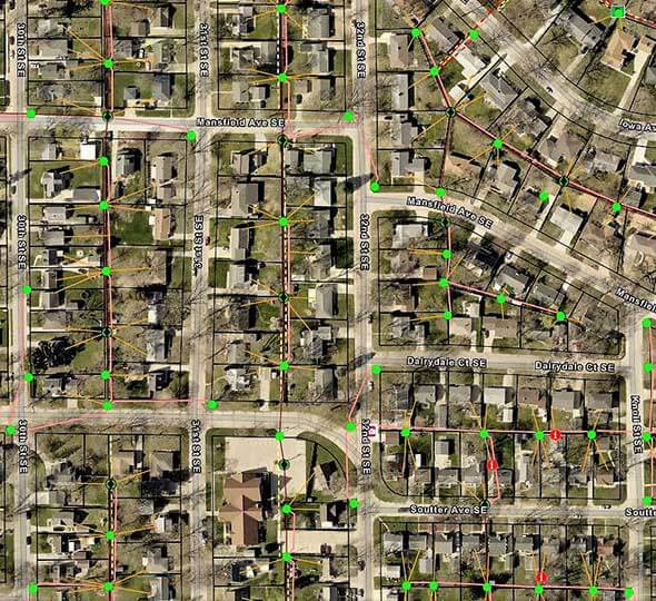
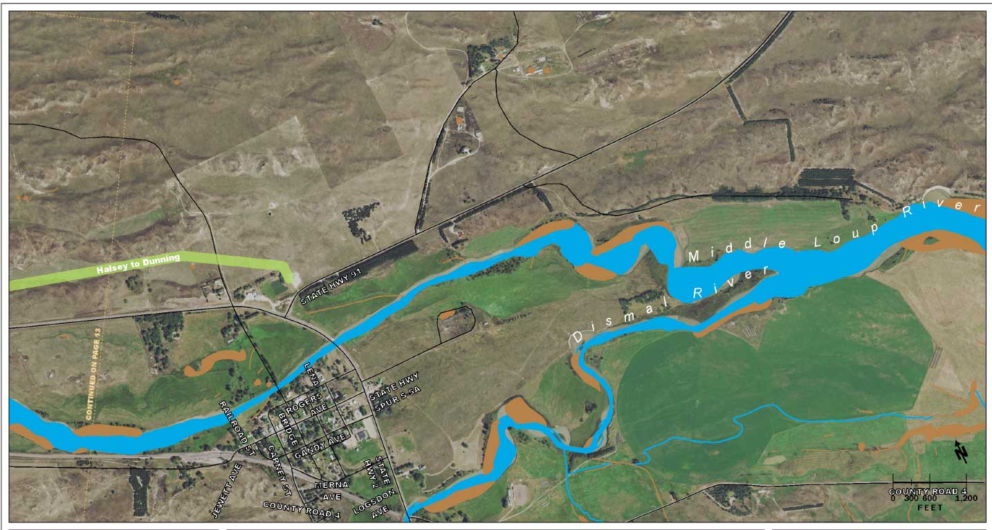
- A variety of relevant data layers that can be turned off and on for easier visualization, which can be filtered by custom radius pins, including but not limited to; Engineering design data, ALTA surveys, permitting and Environmental constraints.
- Terrain maps featuring several layers such as terrain slope and bedrock depth.
- ‘Comments’ feature, which cuts down on information transfer, making collaboration easier and ensuring no messages or tasks get lost in translation. Comments can be assigned to individuals for project tasks and can be resolved when completed.
- Tools in the mobile app format such as: measurement tools, coordinate conversion, filters, etc.
- GPS utility data collection.
- As-built document scanning and map data integration.
- Integration with drone imagery and 3D models.
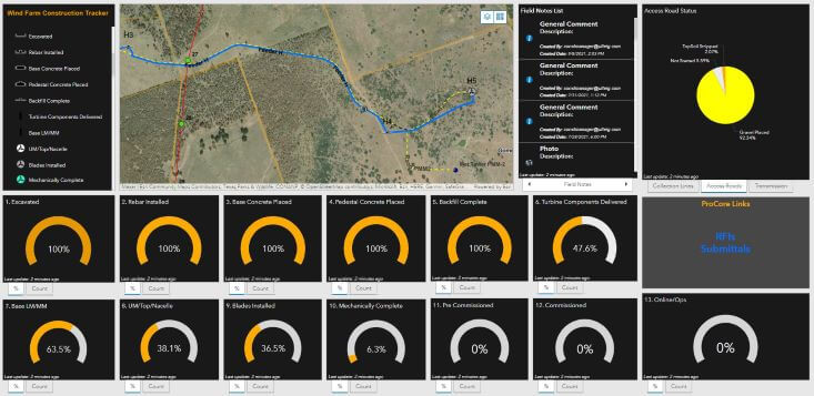
- Project status tracking dashboards for quick and accessible visualization.
Reducing the Communication Gap
Because experts from each discipline involved in a project typically utilize different software, the result is generally that much of the data generated by each party is unable to be easily transferred or shared, which lends itself to slowing down a project, errors and inaccuracies, and miscommunication.
In contrast, this new GIS interface offering is designed to establish one central location for data, which is downloadable in multiple formats such as Shapefile, Excel Spreadsheet, File Geodatabase, and KML, among other less-common file types. This capability establishes one standardized, widespread language for every discipline involved in a project, decreasing technical hiccups and excess time spent transferring files while strengthening communication between parties.
“In the absence of a holistic software, coordination between teams is so prone to error,” said Kyle Smith, Associate Director, Business Development – Expansion Markets at Ulteig. “For this reason, speed and accuracy are some of the strongest benefits of Ulteig’s GIS online interface. Because everyone works in one standardized language, every party involved is more likely to get things right – the first time around.”
This all-encompassing interface not only holds value for the project’s immediate team but for everyone involved in a project or portfolio of projects. Executive stakeholders and project developers, for example, gain much desired real-time access to project progress by simply logging on to their dashboard and being able to quickly visualize the status of each project and its various scope components. Additionally, field personnel can view the design and the environmental constraints for themselves before they are ever even physically on the site. They can document notes and take photos directly from the mobile app version of the online system, saving an enormous amount of time and allowing for unencumbered organization.
A Customized Interface for Unique Jobs
One of the most advantageous components of the offering is its customizable nature.
 “The online interface is so customizable, it allows us to better meet the needs of our clients,” said Greta Robinson, Lead GIS Analyst at Ulteig. “Some clients like online interfaces that are more project management focused, while other clients want something more risk management focused. Other clients purely want a dashboard that tracks field activity. In developing the system and using it with some of our clients, we’ve learned to build it their way. And that may vary from one client to the next, depending upon what’s important to them.”
The high potential for individual project customization opens up a world of possibilities for Ulteig’s project management interface, including:
- One homepage for multiple projects – Clients who are involved in multiple projects can access the entire portfolio from one homepage. They have the ability to access all of their data in one place, as well as the capacity to run a comparison analysis across projects.
- High capacity for technological connection and integration – Information drawn from a variety of spatial data technologies, such as drone technology, 360 cameras, AutoCAD, and more, can all be accessed and stored in one single location.
- Automatic location pin on photos – When a photo is taken and uploaded to the GIS Web Portal, a point is automatically dropped, logging the location of the photo and even noting which direction one was facing when the photo was taken. This saves time and money spent sifting through photos of one piece of infrastructure or land and remembering exactly where each photo was taken.
- Smart form daily logs – Inspectors can access a smart form located on the system where they can submit photos along with the daily log to generate a daily report. Clients have the option to subscribe to auto-notifications and be updated via email when this daily report is submitted to the GIS Web Portal.
- Adjusted levels of data to accommodate project needs – While some see the value in access to every piece of data and minute status updates, others may only wish to view a general project overview through the online interface. No matter the goal – the level of detail available through the Ulteig interface can be easily adjusted to meet the needs of each individual project and client.
“At the end of the day, location data is critical to decision making, and ultimately, the success of a project,” said Smith. “Not everybody has AutoCAD, not everybody can interpret an engineering drawing, and Google Earth has limitations. If you want to bring in all of the design data, all the landowners, geo-tech, environmental, field notes, photos, LIDAR, all in one place – you really can only do it using a GIS application. Being able to see location data on a web map in an easy-to-use way, has been a game-changer.”
Ulteig: Innovating a New Frontier of Communication Through Technology
To learn more about Ulteig’s GIS services, visit the Geographic Information Systems (GIS) page on the Ulteig website, or contact us here.
WHAT MAKES ULTEIG DIFFERENT?
From global energy producers to locally funded cities and private developers to government agencies, the clients we serve encompass a broad range of relationships and projects. Find out why Ulteig is a leader in the engineering industry.
Contact Us